Hydrographical Survey
- Home
- Service
- Hydrographical Survey
D.S. Consultants & Engineers Pvt. Ltd. is a trusted name in Hydrographical Survey. Equipped with advanced technology and a team of skilled professionals, they specialize in conducting precise underwater mapping, depth measurement and topographical analysis. These survey support a variety of industries, including marine construction, navigation and environmental monitoring. Their commitment to accuracy, efficiency and timely project delivery ensures exceptional service quality. Whether for ports, reservoirs or rivers, D.S. Consultants & Engineers Pvt. Ltd. provides reliable solutions tailored to meet specific client requirements with professionalism and expertise.
Inquiry Now
Hydrographical Survey
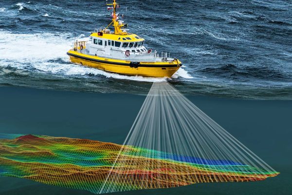
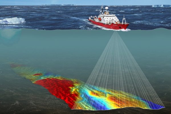
D.S. Consultants & Engineers Pvt. Ltd. is a trusted name in providing comprehensive Hydrographical Survey services . With a team of highly skilled professionals and state-of-the-art technology, the company specializes in mapping water bodies, analyzing underwater terrain and ensuring accurate data for marine and inland projects. These services cater to industries like construction, irrigation, coastal development and navigation.
D.S. Consultants & Engineers Pvt. Ltd. delivers precise bathymetric mapping, current measurement and sediment analysis to meet diverse project requirements. Our commitment to quality and client satisfaction makes us a preferred partner for Hydrographical Survey. Whether for environmental assessments or infrastructure development, we provide reliable insights to support informed decision-making.